Quantum3D Technology Unlocks More Value from Existing Satellite Imagery Data with AI-Powered Super-Scaling
New technology enhances existing satellite imagery by up to 4×, helping reduce the time and cost of developing high-fidelity terrain for modeling, simulation and training
SILICON VALLEY, CA – August 19, 2026 – Quantum3D, Inc., a leading provider of simulation and training solutions, today announced a major expansion of its terrain development portfolio with the introduction of AI-powered image super-scaling for
satellite imagery. The new capability uses advanced AI techniques to enhance existing satellite imagery by up to 4×, providing higher-detail visual content for simulation and training applications while helping customers reduce the significant costs traditionally
associated with acquiring and processing native high-resolution satellite data.
Solving the High Cost of Satellite Data
A primary expense in terrain development is purchasing satellite imagery that maintains clarity at lower flight altitudes. Fixed-wing aircraft simulations typically require 0.25-meter to 1.0-meter resolution around airports. Rotary-wing, eVTOL, and UAV/UAS
simulations often require high-resolution imagery across larger geographic areas, increasing imagery acquisition and terrain-development costs.
Quantum3D’s new proprietary tools solve this bottleneck by using advanced AI techniques to scale satellite images up to 400%. The technology analyzes visual patterns and terrain features to generate enhanced image detail, including sharper road and building edges and improved visual texture across vegetation, soil, sand, and rock surfaces.
The resulting imagery is designed to provide improved visual cues for flight simulation and other applications where visual detail and scene recognition are critical.
AI-enhanced imagery is not a replacement for native high-resolution imagery in every application. Instead, it provides organizations with a cost-effective option to improve visual quality and maximize the value of existing imagery data.
AI Is Changing the Economics of Simulation
“AI is changing the economics of simulation,” said Murat Kose, CEO of Quantum3D. “Instead of assuming that every square kilometer needs expensive native high-resolution imagery, we can use AI to extract more value from the imagery we already have. Our 4× image super-scaling technology gives customers a faster, more scalable way to build high-fidelity synthetic environments and digital twins for modeling, simulation, training, testing, and operational applications.”
Two AI Tools for Existing Workflows
Quantum3D has developed two distinct AI scaling tools to fit existing workflows:
- Source Imagery Scaler: Processes raw source imagery directly from data providers. It seamlessly supports all major geographic imagery formats, including GeoTIFF, JPEG2000, and ECW.
- OGC CDB Terrain Enhancer: Upgrades existing, published Open Geospatial Consortium (OGC) Common Database (CDB) format terrains. It upscales the highest resolution imagery already embedded in the terrain to generate up to two additional levels of detail (LOD), effectively quadrupling the resolution.
Global Scale and Cost Efficiencies
The new technology enhances Quantum3D’s existing worldwide CDB background terrain offering, which includes 15-meter global imagery and 10-meter imagery for the Continental United States. By applying AI image super-scaling, Quantum3D can optionally provide enhanced imagery derived from this existing dataset at an effective 3.75-meter pixel scale for worldwide coverage and 2.5-meter pixel scale for U.S. coverage.
Furthermore, clients can capture substantial budget savings when building custom areas of interest. For example, instead of purchasing expensive native 0.5-meter imagery, developers can now utilize super-scaled 2.0-meter imagery to achieve comparable
simulation experience.
Applications Across Aerospace, Defense and Commercial Aviation
Quantum3D’s AI image super-scaling technology can support the development of high-fidelity visual environments for:
- Flight simulation and training
- Rotary-wing, eVTOL, and UAV/UAS applications
- Mission rehearsal
- Aerospace and defense simulation
- Synthetic environments and digital twins
- Large-area terrain databases
- Testing, evaluation, and operational applications
The technology complements Quantum3D’s existing MANTIS® image generation, CDB terrain visual database, and simulation technologies, providing customers with another tool for creating scalable, high-fidelity visual environments.
Availability
Ready to see what AI image super-scaling can do for your terrain? Contact Quantum3D to schedule a demonstration, evaluate the technology with your existing imagery or CDB terrain, and discuss your project requirements.
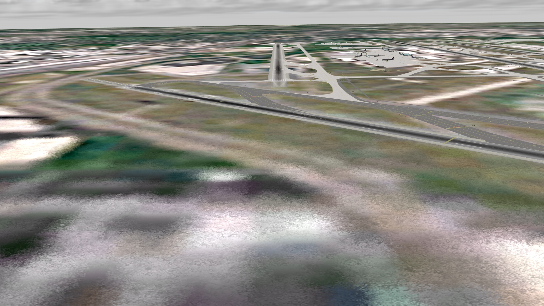
Before
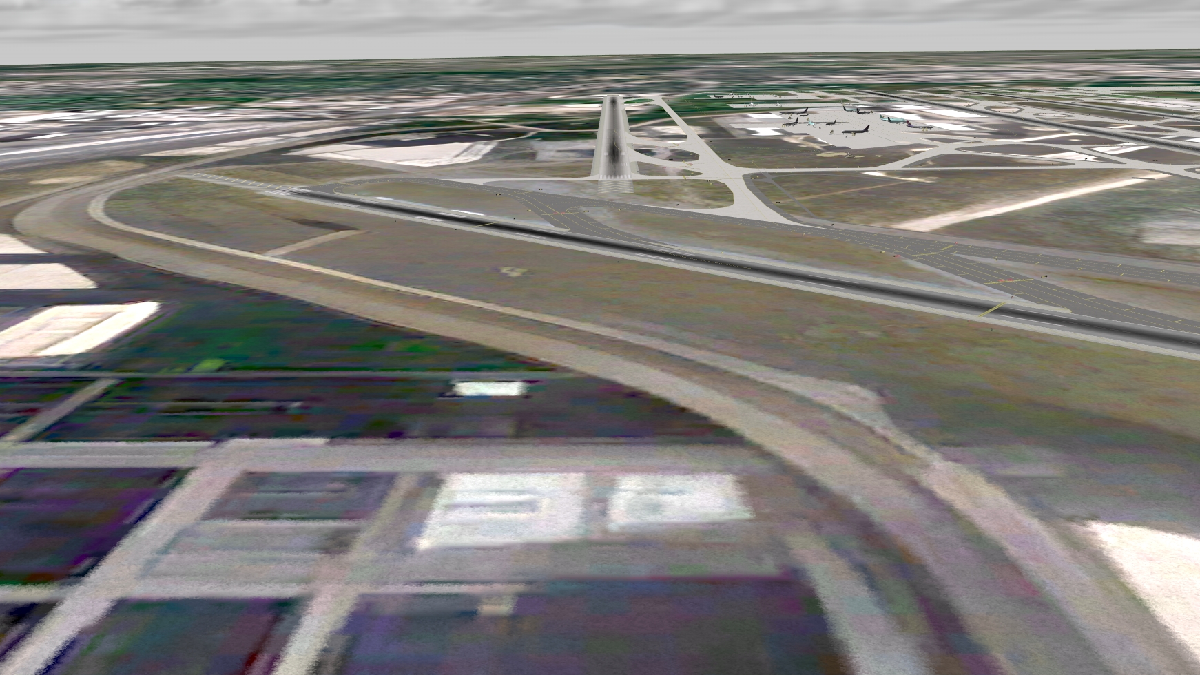
After
About Quantum3D
Quantum3D is a leading developer and provider of simulation and training products, as well as the technology that drives them. For 29 Years, This Silicon Valley Company has been providing advanced training and simulation technologies to a wide spectrum of
industries. Our expertise extends to the military, space, air ambulance, search and rescue, aerial firefighting, commercial aviation, and advanced air mobility industries (AAM, eVTOL, Air taxi, Flying cars).
MANTIS® is a registered trademark of Quantum3D, Inc. All other trademarks are the property of their respective owners.

