Forest Firefighting Training Simulator
FireFLY
The Forest Firefighting Training Simulator has been designed to improve organization and coordination capabilities in fighting forest fires.
FireFLY provides a capability to train those Forest Service members who are responsible for on site coordination and management of forest firefighting activities by utilizing the advantages of simulator techniques and technologies.
•High level incident commander
•Fireline leaders
•Team leaders
•Bulldozer leaders
•Aircraft and helicopter pilots
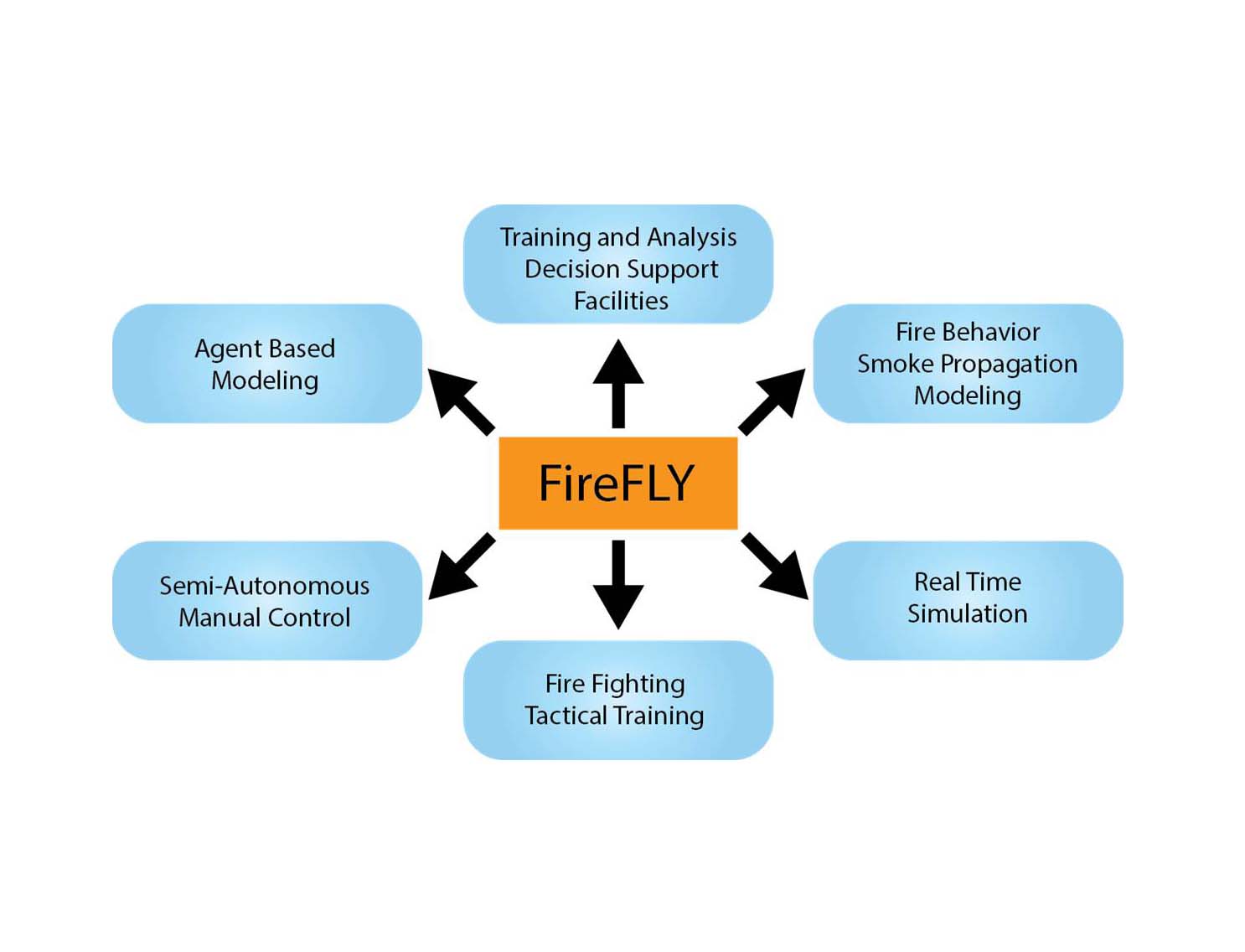
Conceptual Models
Fire Propagation Model
- Tree characteristics
- Type, density, age
- Length, diameter, vertex
- Inflammable matter
- Type, distribution, amount, density
- Humidity, litter cover
- Wind, air temperature, rainfall
- Gale/Wind force
- Moisture
- Terrain and topography
Smoke Propagation Model
- Wind velocity and direction
- Humidity amount of the inflammable matter
- Fire intensity
- Stand type
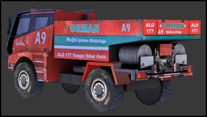
Fire Truck
- Dispense water/chemical from monitor/pump
- Follow routes
- Setup convoys
- Refuel
- Refill water
- Joystick control
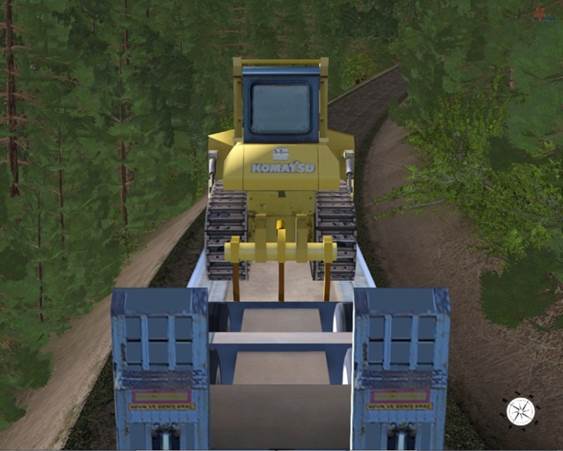
Bulldozer
- Knock down trees
- Construct firelines
- Joystick control
- Construct roads
- Refuel
- Follow routes
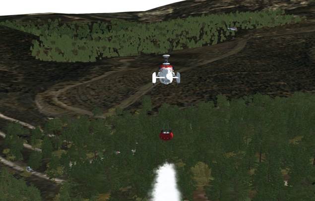
Helicopter and Aircraft
- Glass-Cockpit based joystick control
- Mission assignment
- Take Off/Land/Hover
- Refill water from lake/river/pool
- Transfer firemen
- Refuel
- Dispense water
- Fire intervention
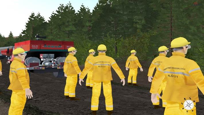
Fireman
- Construct firelines
- Cut down trees
- Dispense water/chemical
- Start controlled fires
- Follow routes
- Lay/Gather hose
- Get on/off land vehicles
- Get on/off helicopters
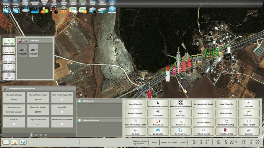
2D Map Properties
- UTM format
- Degree, minute, second
- GPS based vehicle tracking system
- Pan on map
- Detailed satellite photos
- Zoom in/Zoom out
Vehicle Tracking System
FireFLY has a GPS (Global Positioning System) interface with the vehicle tracking system used in the real life operations, so every vehicle used in the FireFLY exercise can also be seen on the vehicle tracking system.
Visual Database and 3D Models
- DTED2 elevation data
- 0.6m resolution satellite map
- Civil cultural elements
- Realistic 3D models
- Vegetation models
- Lakes, rivers
- Tree types
- Normal
- Damaged by fire
- Well/non-well cared states
- 4000 km² scene management area
-

FireFLY Datasheet
Download Now